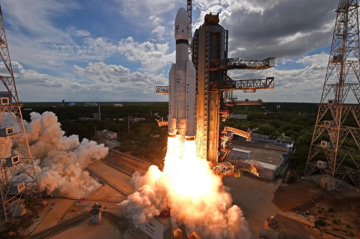
Photo: LVM3 launch, Sriharikota, ISRO, GODL-India

APPSC Group-I Mains 2023 · Paper V
2023 Paper V · Q10(b): model answer
Science, Technology & Environmental Issues · Space, defence and nuclear technology. Held in June 2023 (Notification 28/2022).
Why is monitoring and weather forecasting crucial? Discuss the role of ISRO in the weather prediction and capabilities in Disaster management. Add a note on Mission NISAR.
Syllabus: Space, defence and nuclear technology · Space technology
Weather forecastingEarth-observation satellitesDisaster managementNISAR
India's farms, coasts and cities depend on the monsoon and are exposed to cyclones, floods, droughts and heat waves. Accurate monitoring and forecasting turns these hazards into manageable events: early warning and evacuation have made deaths in recent cyclones such as Hudhud (2014) far fewer than in the Diviseema cyclone (1977). ISRO provides the eyes in the sky, while IMD, INCOIS, CWC and the disaster authorities turn the data into forecasts and warnings.
1. Why monitoring and forecasting are crucial
- Agriculture: sowing, irrigation and harvesting follow monsoon onset and rain forecasts; agromet advisories cut losses for rainfed farmers.
- Saving lives: cyclone track and landfall forecasts, flood and heat-wave warnings give days for evacuation, a priority of the Sendai Framework.
- Economy: aviation, shipping, fisheries, reservoir operation and power grids that must forecast solar and wind output all need weather data.
- Climate change: warmer seas make cyclones intensify rapidly and rainfall more extreme, so warnings must be faster and more local.
2. ISRO's role in weather prediction
- Geostationary weather satellites: INSAT-3D (2013), 3DR (2016) and 3DS (2024) carry an imager and a sounder that profiles temperature and humidity; frequent images fix a cyclone's centre and track.
- Ocean data: Oceansat-3 measures ocean colour and winds; satellite data reach IMD and other users through MOSDAC (Space Applications Centre, Ahmedabad).
- New eyes: EOS-05 (GISAT-1A, September 2026), India's first imaging satellite in geosynchronous orbit, watches the same region many times a day.
- Research and models: NARL at Gadanki studies the atmosphere with radars, and Mission Mausam (2024, ₹2,000 crore) adds radars, satellites and better models.
3. Capabilities in disaster management
- Decision Support Centre (NRSC): near-real-time maps of floods, cyclones, landslides and forest fires through Bhuvan and the National Database for Emergency Management.
- Communication: INSAT/GSAT satellite links and phones work when ground networks fail; GAGAN-based GEMINI devices warn fishermen at sea.
- Damage assessment: high-resolution and radar images guide relief and reconstruction; ISRO is a member of the International Charter "Space and Major Disasters".
4. Mission NISAR
- What: the NASA–ISRO Synthetic Aperture Radar, launched on GSLV-F16 on 30 July 2025 from Sriharikota, the first GSLV mission to a sun-synchronous orbit.
- How: it carries L-band (NASA) and S-band (ISRO) radars that see through cloud and darkness and image the Earth's land and ice every 12 days.
- Uses: small ground movements before earthquakes and landslides, glacier change, crop and soil moisture, floods, coastal erosion and forest biomass.
Schematic map of Andhra Pradesh (2011 census district outlines), not to scale; for study only.
AP angle: IMD's Doppler weather radars at Visakhapatnam and Machilipatnam track storms near landfall, ISRO launches from Sriharikota and NARL studies the atmosphere at Gadanki, while APSDMA's alert systems helped evacuate people before Hudhud (2014) and Montha (2025).
Satellites have made India's forecasts impact-based; NISAR, GISAT and Mission Mausam can now push warnings down to the village, making disaster resilience a reality.
The other choice in Q10
Answer either one in the exam.
Every model answer on these pages is free to read. The Tool Kit adds four PDF books for Mains Papers I–IV: every previous question sorted by syllabus, with practice questions. It is in the ₹149 All-in-One Pass, with every previous paper of every exam on the site, practice quizzes, timed tests, mock test series and study books.
₹149 · valid for 12 months from the day you pay, on every exam · pay by UPI, card or net banking